
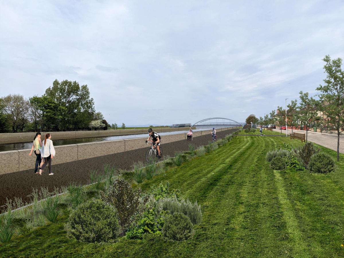
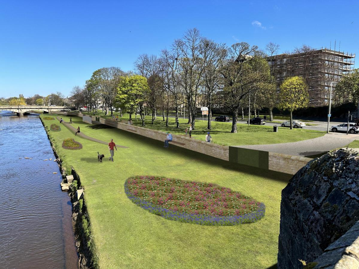
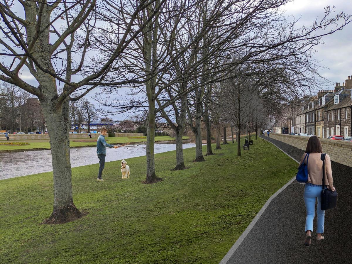
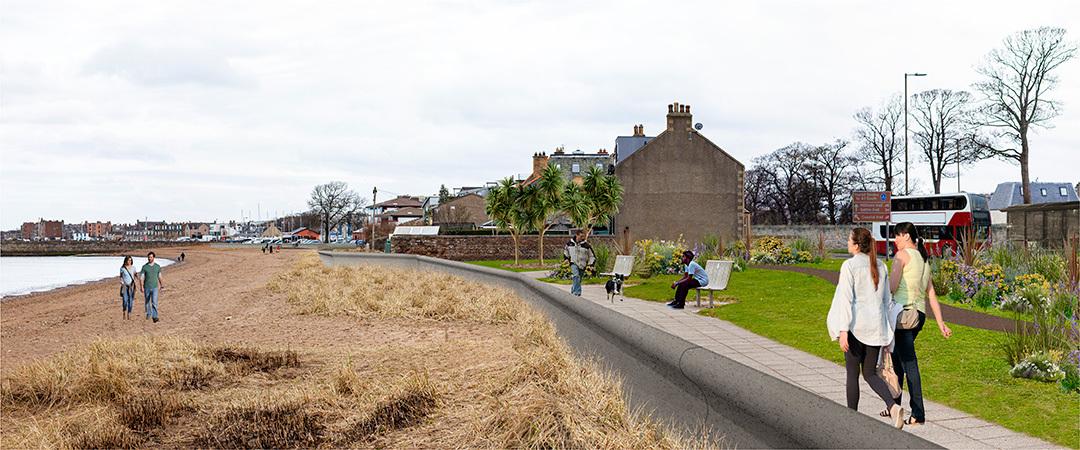
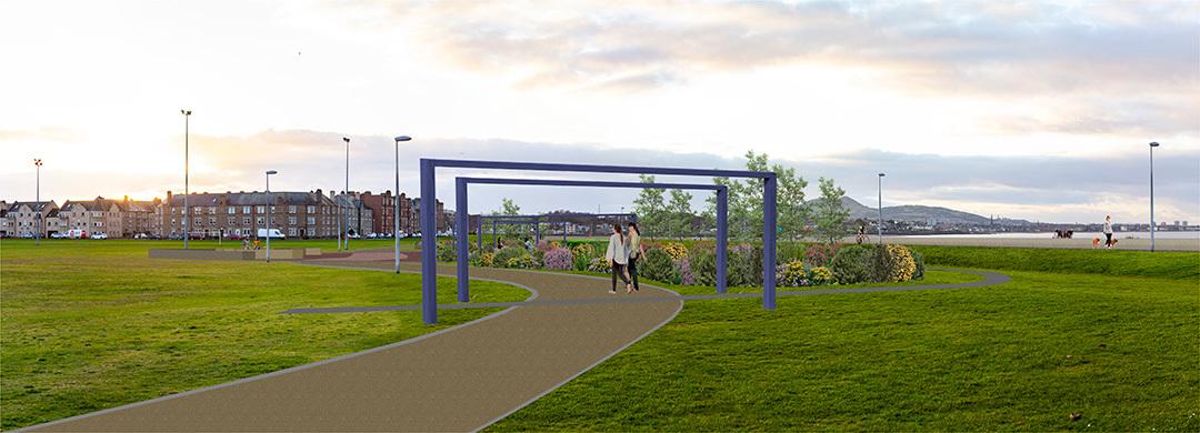
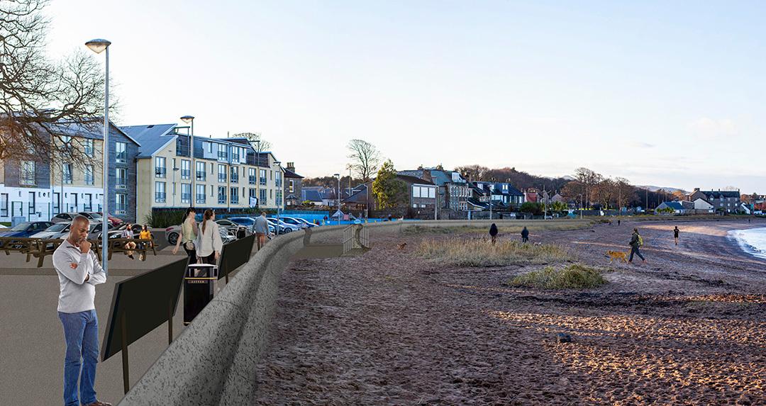
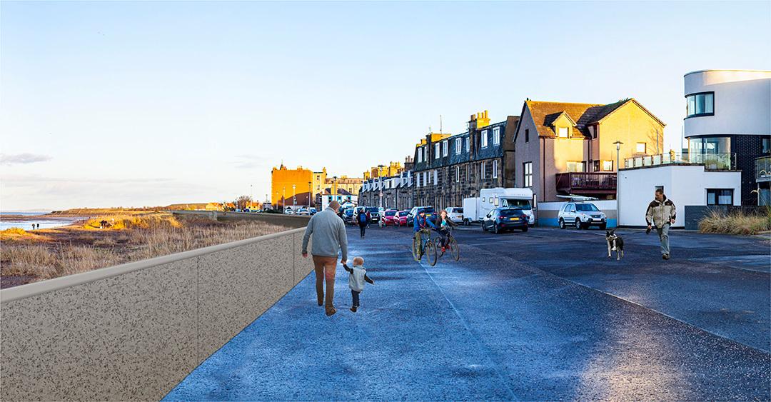
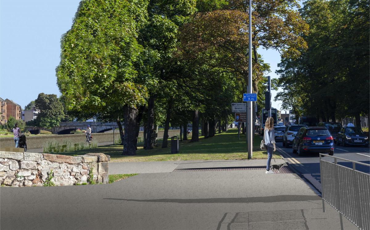

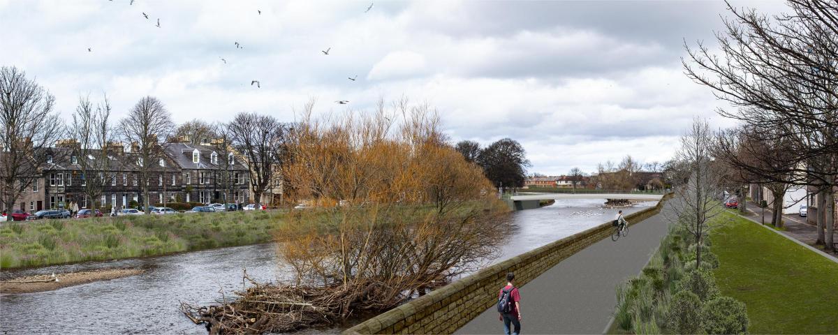
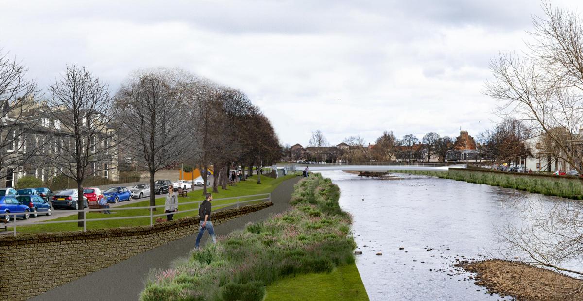
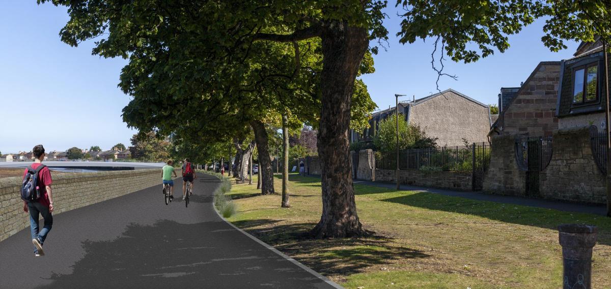
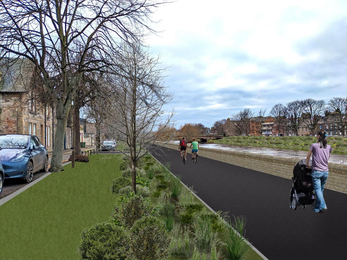
THIS is how Musselburgh could look once flood defences are installed, after councillors this week gave the green light for the controversial project to move forward.

New visualisations showing the town with walls at the riverbanks and coast were produced ahead of Tuesday’s East Lothian Council meeting to “complement the design drawings and prompt further discussions on the proposals”, although it was stressed: “These are not considered to be the final product as the design is not complete.”

At the meeting, the outline design for the Musselburgh Flood Protection Scheme was given the go-ahead to move to the next stage after the council leader warned that future flooding was “almost guaranteed”.

During an eight-hour special meeting of councillors to debate the issue, Councillor Norman Hampshire warned fellow elected members that future generations would suffer unless they took action now to approve the outline design for the £53 million scheme.
")
The scheme will now advance to the next stage, the formal consultation process, when there will be further opportunities for people to lodge their views or objections.

The meeting was told that the scheme was still a number of years away from being introduced, while a council spokesperson stressed that no final decision on whether to go ahead with it had been made.

The Musselburgh Flood Protection Scheme (MFPS) has sparked controversy in the town after costs soared from the original £8.9 million in 2016 to a current estimate of £53.9 million.

A report to councillors on Tuesday asked them to approve the outline design for the scheme, which, members were told, needed to be submitted to the Scottish Government by March 31 if it were to qualify for 80 per cent funding in a current cycle of grants.

The report revealed that the current estimate for the scheme was now £53.9 million, with two new additional projects – covering repairing and maintaining the sea wall at the town’s ash lagoons, which the council has ownership of, and Musselburgh Active Toun – adding a further £78.6 million onto the overall work planned for the town.

Opponents of the MFPS, which includes the introduction of walls through the town centre, wanted it paused, claiming that not enough work has been carried out to find “natural solutions” instead. They claimed that less than a tenth of the outline design for the scheme used natural options.

The Musselburgh project aims to protect the town from flooding from the coast and the River Esk which runs through its centre.

Current plans include 4.7km of flood walls with 1.7km made up of “flood embankments and hybrid structures”.

New design proposals for the scheme show that much of the flood walls proposed for areas around the River Esk have been reduced in height to one metre to address concerns over their impact.

A petition calling for the project to be paused was considered by councillors alongside the report.

The council approved the outline design moving forward to the next stage of development by 15 votes to five, with a Conservative amendment to support the petition failing by 16 votes to four.
Visit musselburghfloodprotection.com/outlinedesign-councilmeeting for more information and to see all the visualisations.


Comments: Our rules
We want our comments to be a lively and valuable part of our community - a place where readers can debate and engage with the most important local issues. The ability to comment on our stories is a privilege, not a right, however, and that privilege may be withdrawn if it is abused or misused.
Please report any comments that break our rules.
Read the rules hereLast Updated:
Report this comment Cancel