
KEY steps will be taken in the coming weeks in a bid to protect Musselburgh from the risk of flooding – with 2,500 properties in the town under threat from a major flood event.
A £42 million preferred flood protection scheme, approved by East Lothian Council in January 2020, aims to introduce defences against a one-in-200-year risk of flooding in the town.
At risk of a major flood event are about 2,500 properties in an area covering the whole of High Street and Eskmills Business Park; Musselburgh Racecourse; Fisherrow Harbour; significant parts of Loretto School and its grounds; the A199; the town’s two road bridges and all of its footbridges; along with residential properties and businesses.
Various public consultation events have already taken place, with the project team holding another series of events at The Brunton this week.
New flood maps, said to be the “most accurate” yet developed for Musselburgh, have been also published and can been viewed on the scheme’s website at musselburghfloodprotection.com

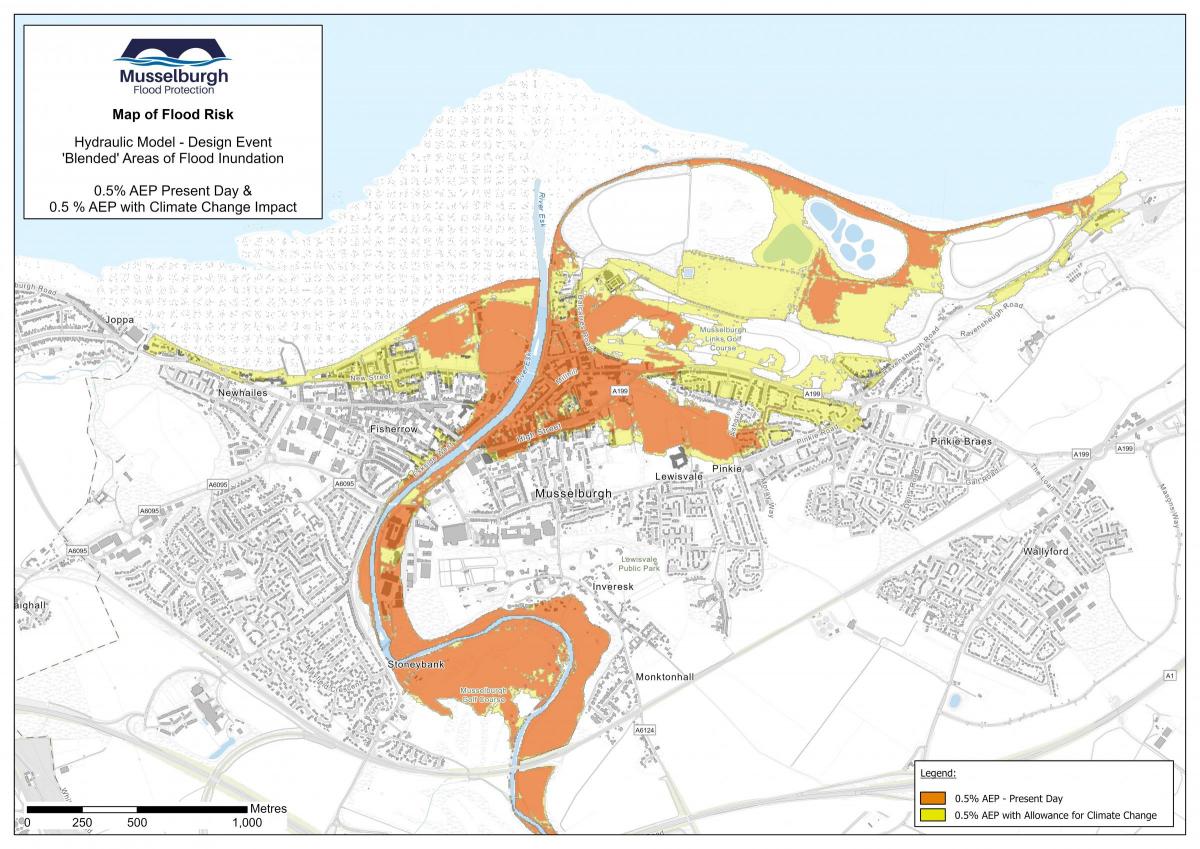
Shaded in red on this map of Musselburgh are the areas considered most at risk from flooding, while those in yellow could also be at risk as a result of climate change
A local area consultation meeting was arranged on Tuesday to look at the proposed approach to defences along the River Esk corridor, bringing together the previously consulted groups at Goosegreen, Esksides, Eskmills and Inveresk.
Another meeting the following day to look at coastal defences along the foreshore, from the mouth of the River Esk to the Magdalene Bridge on the Brunstane Burn, aimed to involve groups at Edinburgh Road, Fisherrow Promenade and Mountjoy areas.
The whole town will be consulted at a meeting at The Brunton on March 8. It is intended that this will summarise the whole phase of consultation and identify the next steps for the project – part of which would involve removal and replacement of the Goosegreen footbridge, Electric Bridge and Shorthope Street footbridge. It is also proposed to replace the Ivanhoe footbridge.
A spokesperson for East Lothian Council said: “The important point at this stage is that there is not yet a preferred form of defence or design.
“It is clear that Musselburgh has a major flood risk, with around 2,500 properties at risk, and the Musselburgh Flood Protection Scheme is a project that is working to reduce that flood risk.

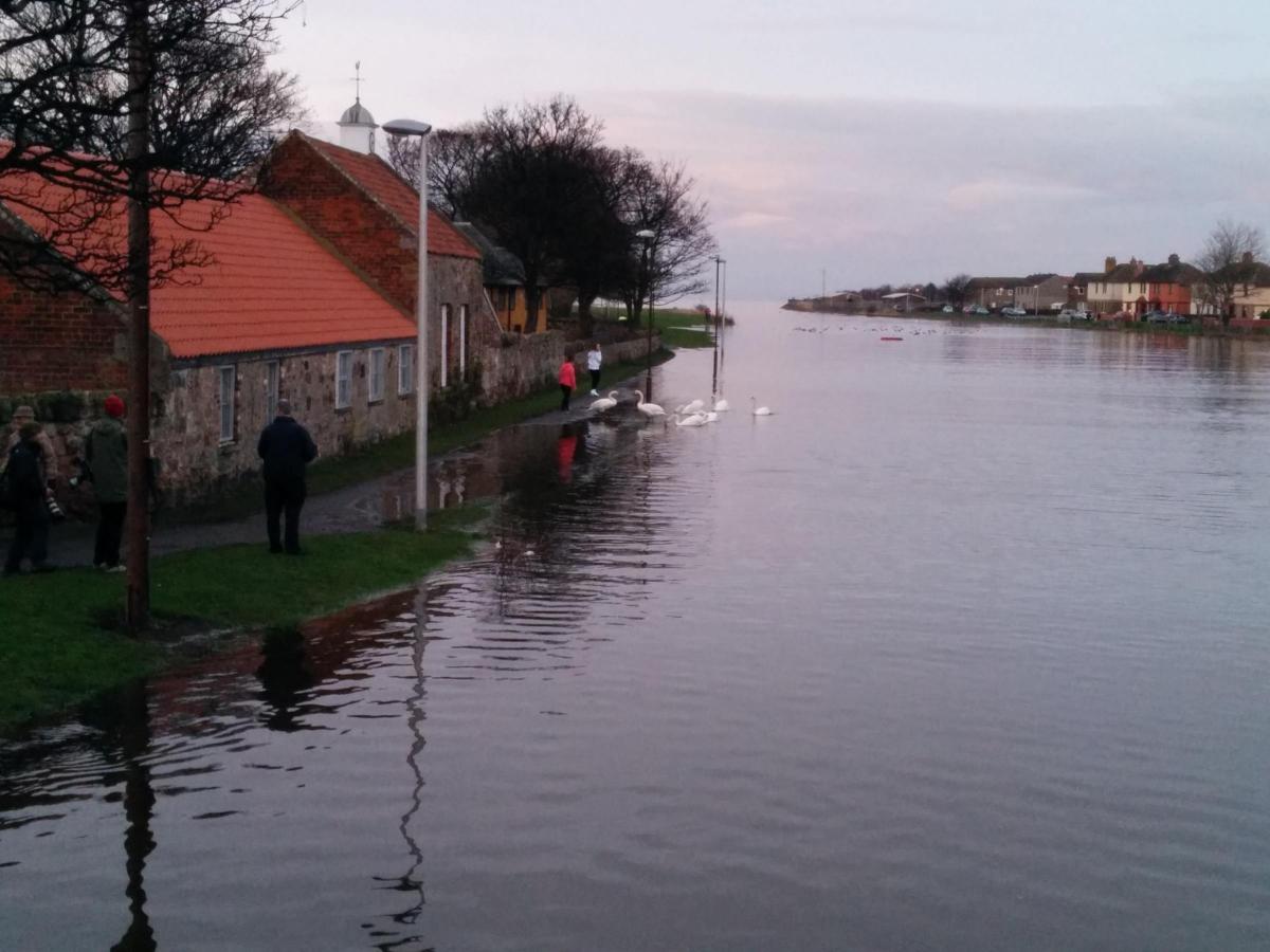
Plans to tackle flooding in Musselburgh are being discussed. Picture: Scott Watt
“The preferred scheme previously stated that the new river defences should be a combination of an embankment and a series of walls. Following the autumn local area consultation meetings, this was revised to state the new river defences must provide a physical barrier along the length of the Esk through the town to stop the water inundating the town behind it. The form of those new physical defences is yet to be determined and could be an earthen embankment; a new wall; river form modifications; or a combination of these forms.
“The project team would like to reiterate, though, that the previous statement, that it is required to replace a number of the town’s bridges with new structures, remains fully correct.
“This week’s further consultation events will give local residents and businesses the opportunity to seek clarification on the proposals and also for the project team to address concerns. These will help shape a draft outline design expected to be completed by late spring and, when this is developed, it will be part of a proposed further public exhibition later in the year.”
History of flooding
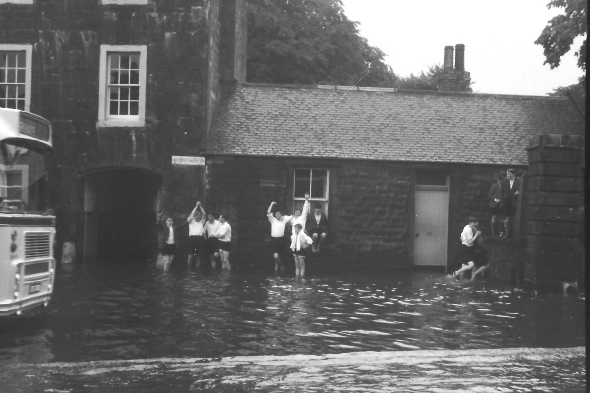
The project team said that the risk from the River Esk was not new and the town had a history of flooding – the most notable events being in 1891, 1927 and 1948.
They added that the risk of flooding from the sea was also not new and events as frequent as a spring tide, combined with a storm surge, had the ability to inundate the river’s flood plains around the mouth of the River Esk estuary.

This photo of historical flooding in Musselburgh was provided by Keith Brodie via Loretto Library
The risk of flooding from the sea would, however, be “substantially increased” due to the impact of climate change raising sea levels, they added.
Conor Price, project manager, said: “It is highlighted that the project currently remains ‘off-programme’ – i.e. that it does not have clear, future target dates through to completion of the outline design and thereafter scheme approval.
“This is due to the impact of the Covid-19 pandemic over the past 22 months, and the commitment of the scheme to advance through a process of consultation.
“It is felt that if this current phase of consultation had been ‘programme constrained’ to a specific duration, this could have restricted a full and comprehensive consultation with the town.
“At this point, it is now reasonably considered that this phase may be drawn to completion in March, and the project team look forward to confirming a new, approved programme thereafter.”

This photo of historical flooding in Musselburgh was provided by Keith Brodie via Loretto Library
Councillor Norman Hampshire, leader of East Lothian Council, said: “East Lothian Council recognises it is essential to advance a flood protection scheme to reduce the flood risk to Musselburgh.
“The scale of the flood risk and the impact that a major flood would have on the town and its people is almost impossible to imagine.
“Provision of flood protection will require a major civil engineering project and significant levels of capital funding. The council are therefore comforted that the Musselburgh Flood Protection Scheme is one of the Scottish Government’s priority schemes for delivery.
“The project team who are advancing the scheme are now in the final stages of preparing to commence actual design of flood risk reduction options.
“The completion of the definition of the flood risk is another major achievement and one that was critical to complete before the design of any defences could commence.”
He said a full report on the scheme and feedback to it would be presented to the full council for its “consideration and direction”.


Comments: Our rules
We want our comments to be a lively and valuable part of our community - a place where readers can debate and engage with the most important local issues. The ability to comment on our stories is a privilege, not a right, however, and that privilege may be withdrawn if it is abused or misused.
Please report any comments that break our rules.
Read the rules hereLast Updated:
Report this comment Cancel