
I LOVE small historic details. They often tell a tale with greater power than grand buildings.
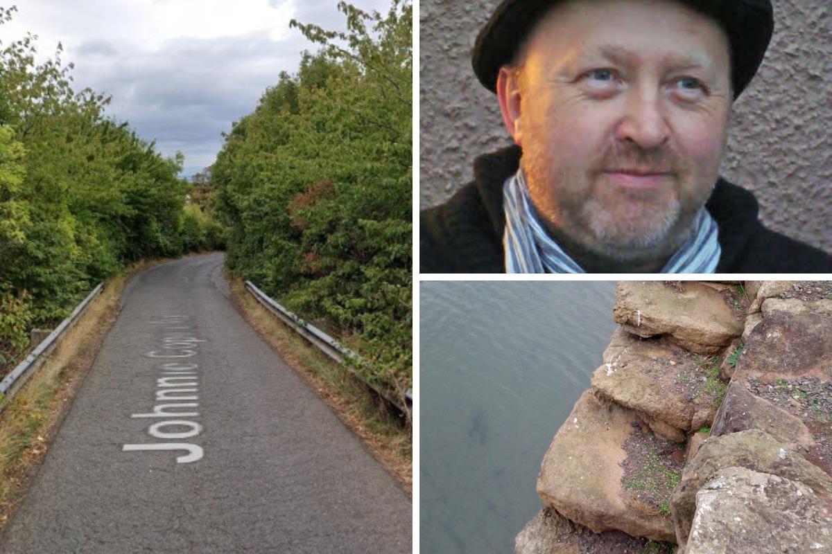
So on a recent trip to Dunbar to visit friends, I was determined to give my regards to Johnnie Cope’s Steps.
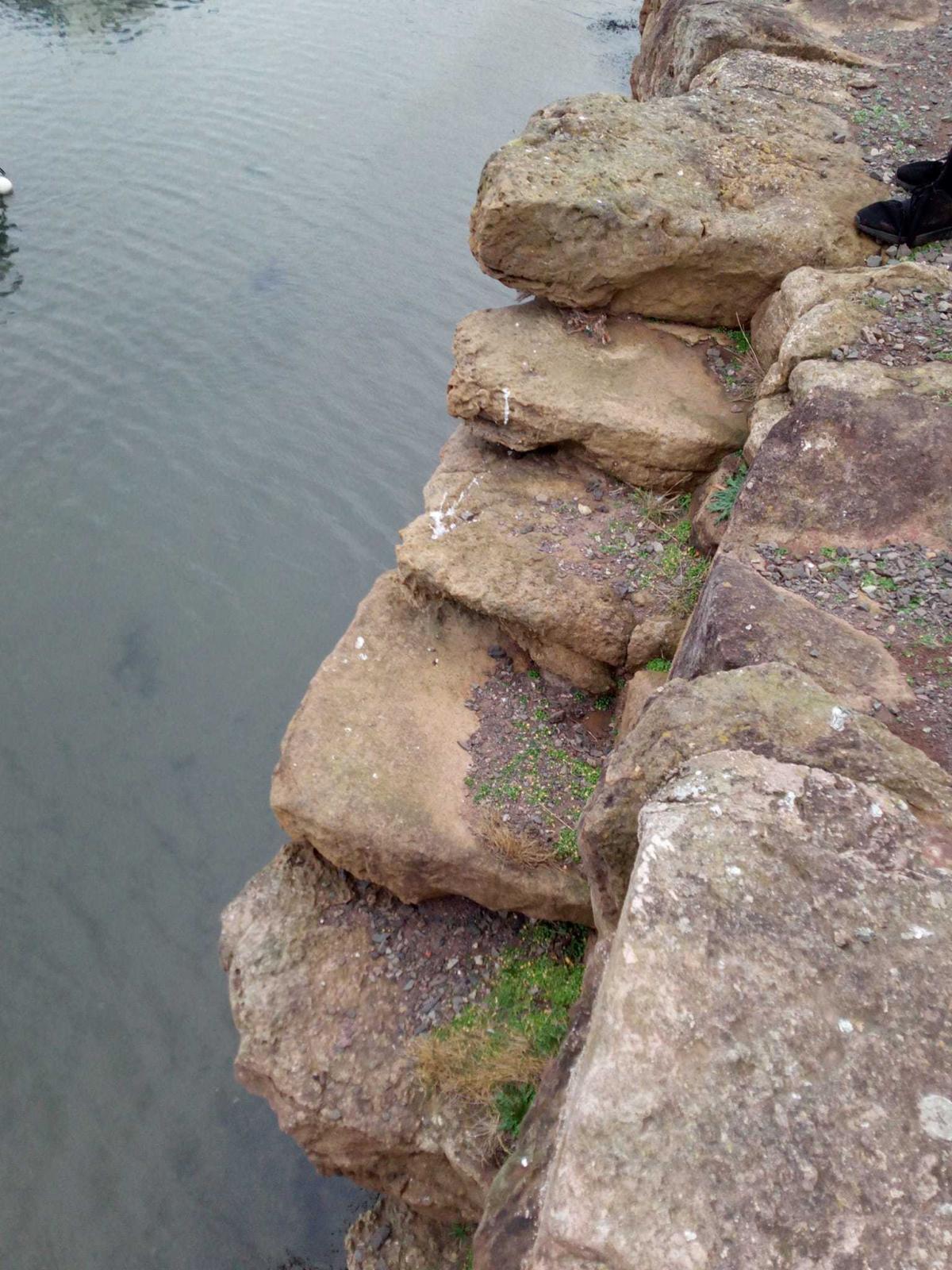
These can be found at the old harbour, referred to as Cromwell’s Harbour after he authorised payment for repairs after a storm. The name for the steps comes from the fact they were probably used by Cope and his soldiers to disembark on September 17, 1745.
I stood a while by the steps, keeping the children away from the edge but taking in the atmosphere of this old harbour, which is full of other fascinating historic details. I imagined the clamour, the noise, sights and smells of that day. The steps are now unsafe-looking and incomplete. But they tell their story.
Cope’s force had sailed from Aberdeen after failing to prevent the Jacobite advance from the north. Well, big time actually, because on the same day the Redcoats arrived at Dunbar, Cope’s adversary, Bonnie Prince Charlie, had entered Edinburgh with his Jacobite army and proclaimed his father king. Cope’s ascent up these steps opened a new chapter in the well-known story of the Jacobite Rising of 1745, which resulted in what’s now called the Battle of Prestonpans.

The story of the battle is, of course, well known, and as a local of the town, the fact it took place on my doorstep always fascinated me, even as a child.
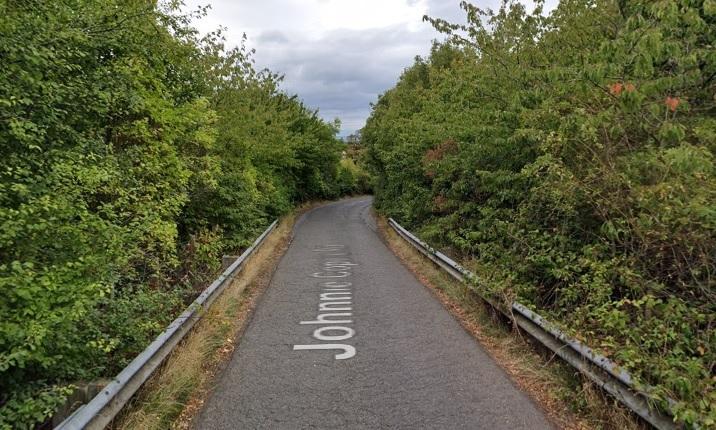
I remember that it was my father who first told me the origin of the name of Johnnie Cope’s Road. We were in his old Morris Minor car, returning from Tranent, where, I recall, he had put a caravan somewhere as a kind of portable church. That’s my memory anyway.
I can’t remember why I was with him on this particular day, but on our return to the Pans he told me: “It feels like a “Johnnie Cope Day.” I wasn’t sure what he meant, so he explained he would go home on the road used by Johnnie Cope’s cavalry to flee from the battle. I already knew the chorus to Adam Skirving’s song Hey Johnnie Cope, although until that time I hadn’t realised its significance.
My father liked the road, perhaps not so much for its history but because of the views it gave, especially when the weather was sunny and clear. This is what my father meant by a “Johnnie Cope Day”, for him it was the scenic route back home from Tranent. That was in the early 1970s and, despite huge changes, including the busy A1 being built across the route, Johnnie Cope’s Road is still used, with a bridge over the motorway.
I suppose Cope’s flight along this road on September 21, 1745, was the closure to the chapter that the steps at Dunbar opened. He was unfortunate that Skirving visited the scene of the battle after the fighting had ended and that his song ridiculing him has since been Cope’s popular epitaph.
It’s typical that the road is named after a military man who, I suspect, would not have remembered it, given the alleged speed with which he galloped along it. But it was the main route to the south and so was the obvious road to take.

But the journeys taken by local miners, fishwives, hawkers, panners, lovers, farmers and tradesfolk give the road a far greater historical significance. There will be hundreds of tales and memories of the road, the main part of which is actually known as Birsley Brae.
And soon, it is proposed by the council, the road will be closed to traffic, as it has been deemed to be “unnecessary”. A new battle involving the road seems to be brewing. Thankfully, this will not be a battle of swords and cannon, but emails and letters, as a consultation on the closure of the road is due to open on Monday.
For me, it raises the question when is a road necessary and for whom? When it’s a historic route used for generations by countless thousands of working people who have used it to connect their two communities for centuries?
When the significance of the road increases, as the other routes become congested and traffic-laden due to developments, and its closure would result in more traffic taking the longer or congested options? When it’s a potentially vital lifeline for people in an emergency? Or maybe all of these things?
Or is the road too ‘rural’ now and unsafe for the increased volume of traffic using it? If so, should it be closed? Or would it be better to invest in it, upgrade it? What would that entail? Just repair the road surface? Put traffic lights on the narrow bridge and calming measures to reduce speed? What about cyclists and pedestrians, wheelchair users and others who could use the road, which, to be honest, is currently unsafe for them?
Whatever is decided, investment is going to be needed. Sadly, the road is currently in a neglected condition, pot marked and strewn with litter. I see this moment as an opportunity for creative solutions, to find ways to make this historic road, and essential link, both safe and desirable for all users. But that’s just one opinion, what’s yours?
The communities must have their say in this: is it the end of the story, or the beginning of a new chapter for this old road?
Let the council know what you think.


Comments: Our rules
We want our comments to be a lively and valuable part of our community - a place where readers can debate and engage with the most important local issues. The ability to comment on our stories is a privilege, not a right, however, and that privilege may be withdrawn if it is abused or misused.
Please report any comments that break our rules.
Read the rules hereLast Updated:
Report this comment Cancel